Geodata International 6.10 Details
Data Only 1.14 MB
Geodata International - World-wide database of countries with georeferenced towns, municipalities, postal codes and administrative units with WGS84 and UTM coordinates and elevations for geocoding, proximity search, navigation, distance calculation. The database tables are present in the file format CSV (Comma Separated Values). The character set used is UTF8. This format is used often and in most cases you can import th data directly.
Publisher Description
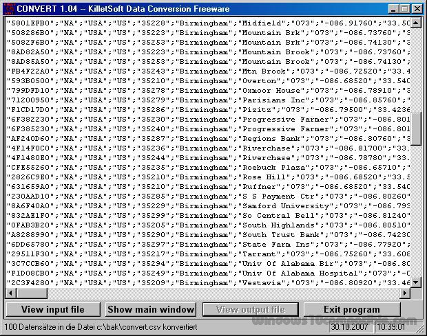
 Geodata International - World-wide database of countries with georeferenced towns, municipalities, postal codes and administrative units with WGS84 and UTM coordinates and elevations for geocoding, proximity search, navigation, distance calculation. Often is it necessarily, for an address characteristic, e.g. the place name or the postal code, to establish a local relationship - a georeference. The georeference can be used e.g. to show a customer the nearest chain store by doing a proximity search. On the basis of the georeferences business zones, statistics or general maps can be made. Towns, municipalities and postal codes can be assigned to the superordinated administrative units. Distances between places or postal areas can be determined with the coordinates contained in the database tables. For that the georeferences are available in all country database tables as UTM coordinates on the natural and an uniformly meridian strip and as geographical coordinates in degree and deg/min/sec notation. With the elevation data from a Digital Elevation Model the ground level height of each place can be determined. The database tables are present in the file format CSV (Comma Separated Values). The character set used is UTF8. This format is used often and in most cases you can import data directly into your own data system. The freeware program CONVERT, downloadable from the KilletSoft site, converts the available database tables to other data formats and character sets with the necessary sortings and selections. With the program, for example, CSV data can be converted to the SDF format (Simple Document Format) or to the dBase format. For the use of the data on different platforms it is possible to select between the character sets ASCII, ANSI, UTF8 and UniCode. Thus the import of the data in any database management system or file system will be possible.
Download and use it now: Geodata International
Related Programs
Geodata Germany
The database tables contains geodata of the Federal Republic of Germany with geo referenced towns, municipalities, town quarters and other administrative units, postal codes, telephone preselections, nature areas, landscapes, climatic zones and official topographical cartographies. The data contain coordinates for...
- Data Only
- 20 Jul 2015
- 1.75 MB
ZIP Code Distance Wizard
The ZIP Code Distance Wizard allows you to locate ZIP Codes that are within close proximity of a specified ZIP Code. For example, let's say that you are a direct marketer and you want to send out a mass mailing...
- Shareware
- 20 Jul 2015
- 1.34 MB
DataPipe Database Search Replace
Search and replace inside databases. Fix garbage data, remove binary characters, change embedded UNC paths coded in your database. DataPipe interactively or automatically search/replaces data in ANY table. You can correct capitalization in people's names (a solution to the old...
- Shareware
- 20 Jul 2015
- 8.22 MB
Find it EZ Code Search
Find it EZ Code Search is the most comprehensive universal software source and data search engine. Find it EZ generates complete dependency checklists for underlying data model changes in relational databases ( schema, data and SQL code ), including support...
- Demo
- 20 Jul 2015
- 17.57 MB
Car Listing Script
Car Buy & Sell Directory Script Used Car/New Car/Car Rental Listing Script This is a used car/new car/car rental listing site that allows you to search for cars that you wish to buy, sell or rent. This script is a...
- Demo
- 27 Nov 2015
- 37 KB